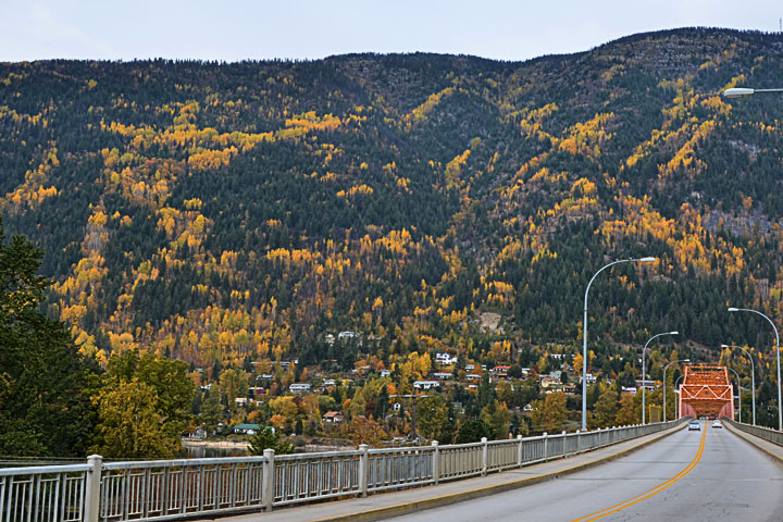
I have long been struck by the patterns of vegetation on Elephant Mountain (officially known as Mt. Nelson) across the water from the city of Nelson. Why is there this odd pattern of coniferous and deciduous trees? It is particularly visible in the fall when the deciduous trees turn colour, but also apparent in the winter when they have dropped their leaves.
Is this pattern random? Does it reveal some underlying structure?
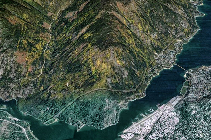
One way to assess the issue is to look at the mountain from various perspectives and see if a regular pattern emerges. The instrument of choice is Google Earth. The second picture shows such an autumnal view captured in April of 2008. (The present Google view uses an image from a different time of the year and the pattern is not as evident.)
The Google image shows that there is a simple pattern to the deciduous trees on Elephant Mountain and in Grohman valley to the left: the orange lines are nearly parallel to one another and cut across other features of the terrain such as creeks. This implies that the pattern reflects an underlying geological structure. What it is, is as yet unclear.
The lines of deciduous trees on Elephant Mountain, as seen from the bridge, look somewhat chaotic.
When seen from the east in Google Earth (2008), many of the lines of deciduous trees seem to be parallel and unrelated to the pattern of drainage. This suggests an origin that lies in the geological structure.


I have often wondered about this, especially at this time of year. I suppose that the next question is: “What is – or are – the underlying geological structure(s) which bring this about?