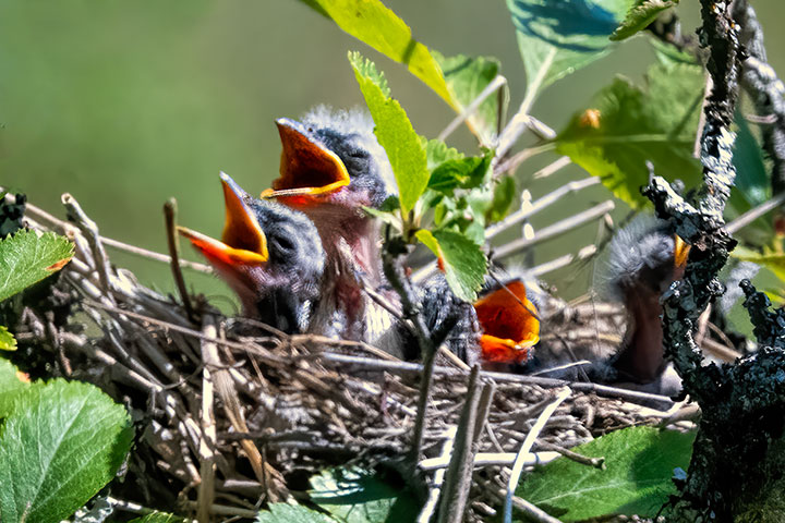
Birds breed in the spring, and then, in the early summer, they raise their chicks. The chicks must go from eggs, to hatchlings, to fledglings, to independent birds during the season. It is a big task for them, but a huge task for their parents.
At this time of year, both parents are often involved in feeding their chicks. This is a full-time job involving finding food, flying it to the nest, feeding the chicks, and removing the faecal sacs. This is done repeatedly throughout daylight hours.
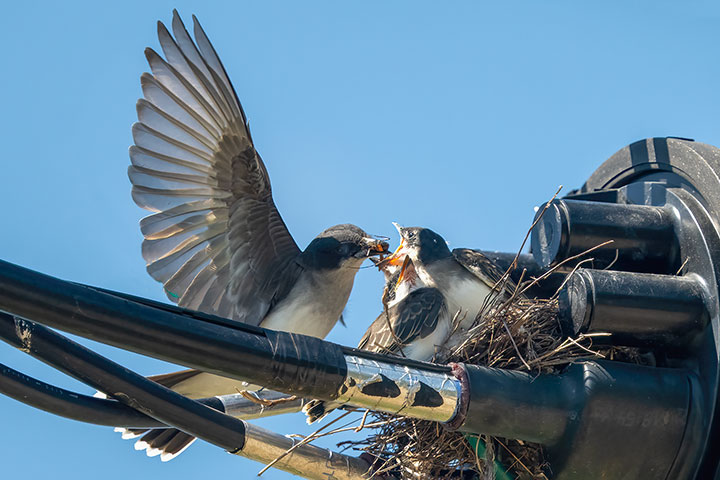
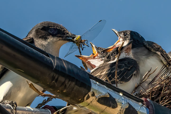
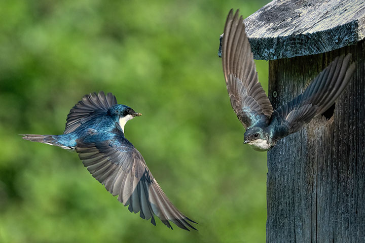
I have watched a number of nests, but this posting is about a Tree Swallow couple and their cavity nest. (Tree Swallows seem to favour cavity nests previously made by humans or flickers.) This posting shows three pictures of swallow parents both coming and going adjacent to the nest cavity.
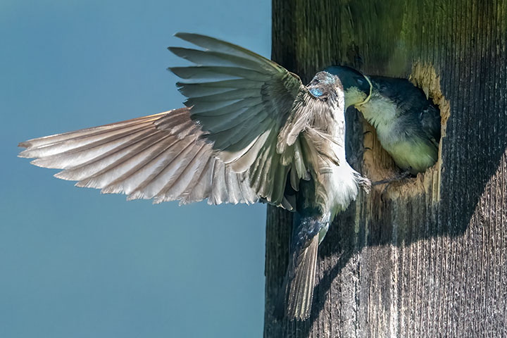
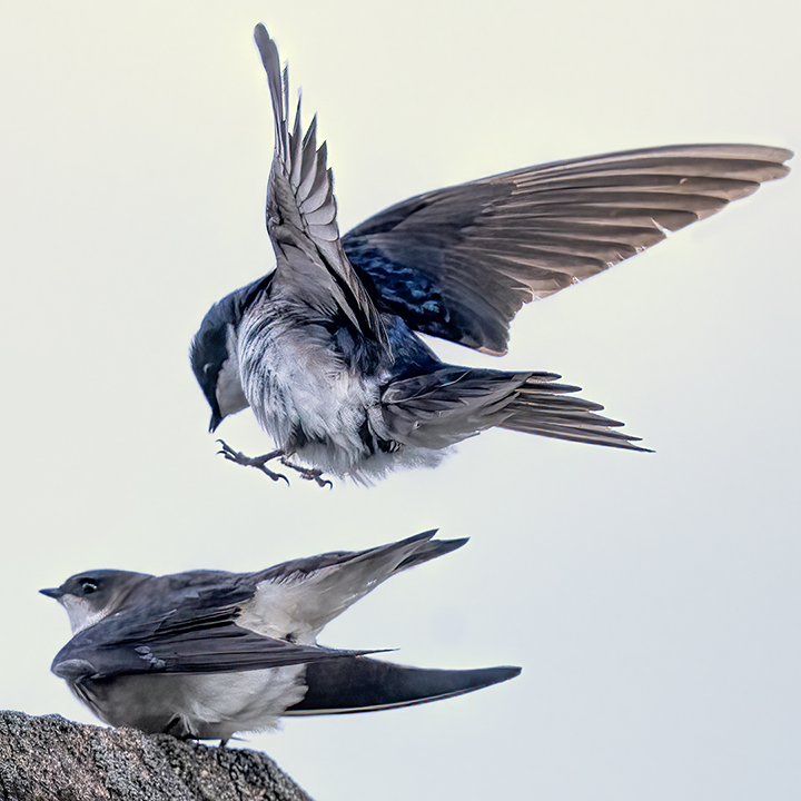
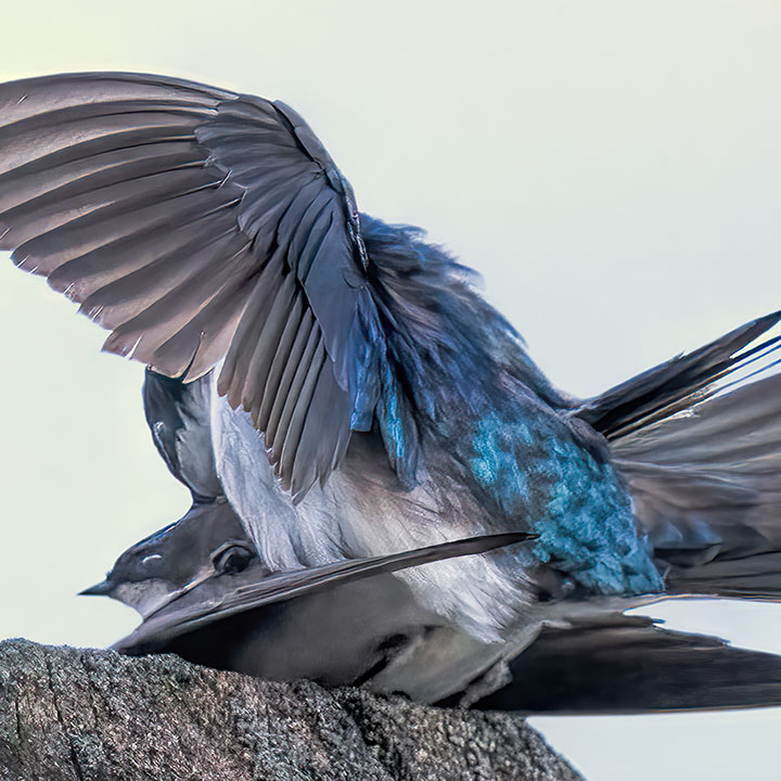
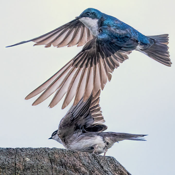
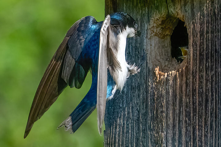
One of the parents typically sits at the cavity opening while the other hunts for food, in this case grubs or insects. When the other parent is seen approaching, the watching parent flies off to hunt, and the process is reversed. They cross the picture space near the cavity in a small fraction of a second, usually on their own. Very occasionally they both appear in the same shot. It is these pictures that I have shown.
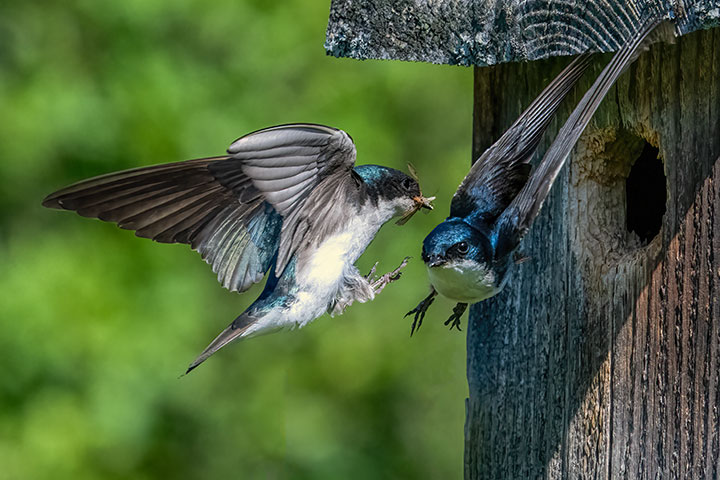
The male Tree Swallow approaches with food in his mouth for the chicks in the cavity nest. Having fed the chicks with her offerings, the female leaves the nest to go hunting.
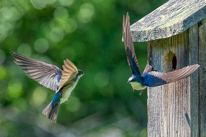
Here the female approaches with an insect dangling out of her mouth, while the male leaves to find more chick food.
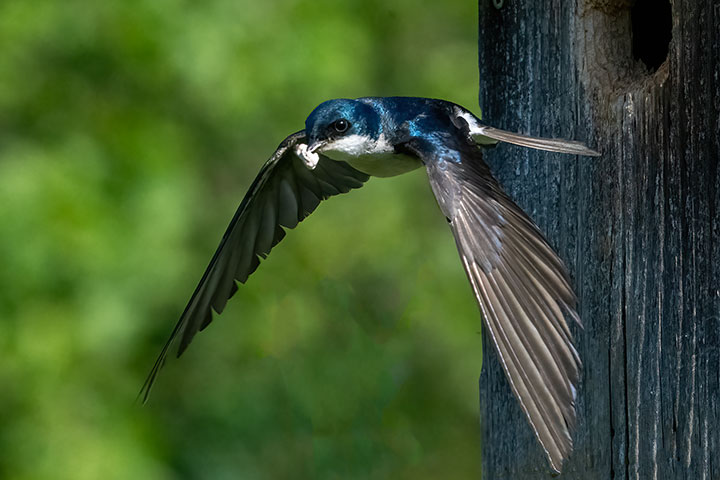
Food brought t0 the chicks is not always evident as it is may be inside the adult’s mouth.
Frequently, one or the other will leave the cavity nest with a faecal sac. This is carried far away from the nest and dropped where it will not attract predators to the nest.
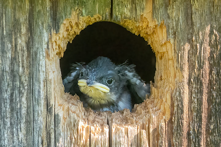
A couple of days ago, we first saw a chick at the nest opening. I looked forward to the chicks sticking their heads out and begging on subsequent days.
One of the chicks appeared at the nest hole merely to wonder at the strange world outside. Photo by Cynthia Fraser.
Early the next morning, there were no chicks, no adults, and the cavity nest had been attacked. The likely culprit was a racoon. It has the power and dexterity to rip open the cavity nest. Undoubtedly the chicks, which could not yet fly, were eaten. The parents flew off. Some detached feathers can be seen behind the broken side. Photo by Cynthia.

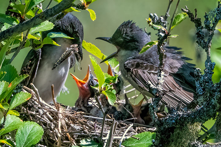
As a solace for the death of these chicks, here is a shot from another nest cavity of a parent placing food into the chick’s mouth. This chick apparently fledged and left.