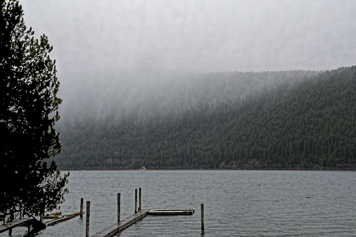
At this time of year, weather forecasts often tell of snow in the mountains and rain in the valleys. The forecast sometimes gives an altitude where the transition takes place. Leaving aside the appearance of the transition on the ground (ski above, hike below), what does it look like in the atmosphere? Curiously, the snow-rain boundary in the air can appear to be abrupt.
When falling snow melts to form rain, the visibility of each is quite different. There are two reasons for this:
• When a snow crystal melts to form a raindrop, the surface area that can reflect light decreases. The difference can easily be a factor of two.
• The snow has a larger number density than does the rain below the melting level. This is because the rain has a higher terminal velocity than does snow, so it spreads out over a greater height. The difference can easily be a factor of five. A way to visualize this is to think of highway traffic spreading out when moving to a region with a higher speed limit.
Taken together, there is a factor of about ten in visibility with the rain having only about a tenth the visibility of the snow from which it melted. As the rain is comparatively invisible, it almost looks as if the precipitation fell to some level and just stopped.
The mountainside serves as a backdrop for a shower of snow into rain. The relative invisibility of the rain makes it seem as if there is no precipitation below the snow. Nevertheless, it was raining there.