When I was in elementary school, I was taught that when water has a temperature of less than 0 °C (well, 32 °F at that time), it is (invariably) a solid called ice. And I was told that it is a liquid from 0 °C to 100 °C (212 °F), and above that, it is a gas. This was one of a number of misleading quarter truths I was taught about the world.
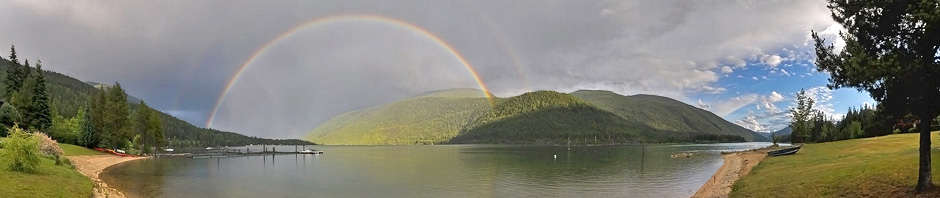
If what my grade-school teacher told me were true, the scene below wouldn’t be possible. Further, much of the world’s weather would be different than it actually is.
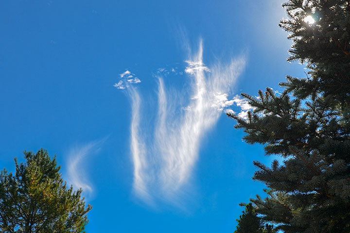
These clouds are cirrus, or more descriptively, fallstreaks. The temperature is well below 0 °C and yet the ragged-looking clouds above the streaks are composed of liquid water droplets, while the streaks are composed of ice crystals. Unseen, but transferring mass between the two is water vapour.
The water droplets are supercooled (still liquid below 0 °C), which is actually a really common state of affairs in the atmosphere. If some of those droplets do freeze, an ice crystal is formed of about the same size. This results in droplets and tiny crystals coexisting in the cloud. This situation is unstable: H2O molecules evaporate from the liquid and condense on the ice crystals causing the water drops to shrink and the crystals to grow. Water vapour is the conduit between the liquid and solid, so all three forms coexist even though the temperature is below 0 °C.
When small, either droplets or crystals have such a tiny terminal fall velocity that the cloud they are in seems to hang in space. However, the ice crystals that have grown at the expense of the droplets have become big enough to have a large terminal fall velocity and so descend in long vertical streaks below the water cloud.
That these fallstreaks are essentially vertical even while the crystals fall through different levels in the atmosphere is a consequence of the lack of wind shear. There is a wind — the streaks are moving across the sky — but it is virtually the same strength throughout the depth of the cloud. If the wind were to change with height, the fallstreaks would assume the shape of a hook.
Fallstreaks contain a mixture of solid, liquid, and vapour, all at a temperature below 0 °C.
Fascinating. For some reason I have observed the cirrus uncinus effect many times (thanks for telling me what to call it) but can’t recall seeing fallstreaks nearly so often. Wonder why? (1) not paying attention (2) location in Michigan midline of lower peninsula (3) time of day ( i.e. middle of the day when working) (4) winds occur more often than calm (5) something else (6) random ?
Leslie, both the vertical streaks and the hooked ones are called fallstreaks (or cirrus). The word, uncinus, is only applied to the hooked ones. The vertical steaks (such as shown above) are less common. At these latitudes there is usually a wind shear (change of wind with height) in the atmosphere. Curiously, it is (mainly) a consequence of the latitudinal temperature gradient.