Recondite names are used for various types of photographic projection: rectilinear (the conventional type), fisheye, equirectangular, stereographic, mollweide—the list is long. Most come from the world of cartography and represent some of the many solutions for mapping a spherical surface (such as the Earth) onto a flat surface.
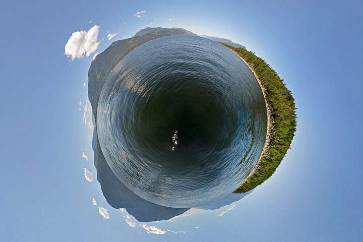
One of these projections—a nearly full-sphere stereographic view centred on the nadir—has become quite popular among those who take extreme panoramas. Indeed, it has gained a catchy name: the little planet.
Last August, when I took a 360° panorama from the centre of the Main Lake, I wanted to transform it into a little-planet view, but a software upgrade had disabled the routine I normally used for this transformation. That functionality having been restored, here it is.
August’s panorama is presented in the style known as the little planet. The location is Kootenay Lake just off the Pilot Bay Peninsula. The image is oriented as the globe of the Earth: north at top, west to left. The view shows the greenery of the peninsula on the right, South Arm at the bottom, West Arm on the left, and North Arm at the top.