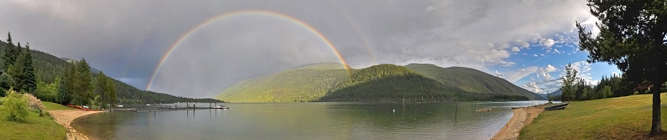
Clear fall mornings are a good time to enjoy the tranquility of ground fog. However, the view from my home is of the Lake rather than of a grassy valley bottom, so I don’t get to see it. Rather, I am more likely to see the frenetic sprites of steam fog. More about this below.
I normally constrain the pictures in this blog to those taken in the vicinity of Kootenay Lake. A picture, rather like the one shown here, could have been taken at either end of the Main Lake, but I am never at those places at the right time. So I am using one taken by Rick Howie near Kamloops, about 300 kilometres to the west.
The fog in this picture is called either radiation fog or ground fog. The first name implies a process (the discussion of which is usually blotched); the second name simply says where it occurs; (and can hardly be faulted).
Condensation
Fog, clouds, dew, and frost all involve the condensation of water vapour to form liquid drops or ice crystals. There are two processes that give rise to condensation: vapour cooling, vapour mixing. Each is distinct (neither is a consequence of the other) and each is well understood.
- Vapour cooling gives rise to most of the drops that form in ascending air: cumulus, cumulonimbus, upslope fog, and cap clouds. It is also the cause of most of the condensation onto a surface: most dew and frost. Many teachers try to explain this condensation by claiming that it occurs because cold air cannot hold as much water vapour as warm air. For two centuries, this assertion has been known to be nonsense, but it still gets taught.
- Vapour mixing requires that two volumes of air with different vapour pressures and temperatures are mixed. During this mixing, the average temperature does not change. Vapour mixing produces many of the fogs near the surface, some types of frost and contails. It is responsible for the fog in the picture.
Typical explanation
A typical explanation of ground (radiation) fog is that offered by Wikipedia in its article on fog.
Radiation fog is formed by the cooling of land after sunset by thermal radiation in calm conditions with clear sky. The cool ground produces condensation in the nearby air by heat conduction.
There are two problems here: 1) The author thinks that the condensation is the result of the cooling of the air (supposedly air is being used as proxy for the vapour); 2) When air is cooled by conduction, it is also dried. Because there is a downward flux of both heat and moisture onto a surface, the result of the described process is dew, not fog. Although superficially compelling, this explanation is physically wrong.
What happens
Notice, when you see such a fog, that it does not actually touch the ground in most places, but appears in layers slightly above it. The formation sequence is as follows:
- Radiation is certainly involved. A cloud-free night allows a net loss of radiation from the ground: the ground emits more energy in the infrared portion of the spectrum than it receives from the air above.
- The temperature of the ground decreases owing to the net energy loss.
- However, the ground not only cools the air above it by conduction, it also dries the air in this thin layer (perhaps a few centimetres) above by diffusion. So far, this explanation follows the typical one, except the counteracting drying of the surface layer is now acknowledged.
- The terrain is uneven and this causes the colder air on sloping surfaces to gently drain into the low-lying regions: There is a gentle katabatic wind.
- The cold air drains into the valley bottoms and pools there. (This downward flow involves two counteracting effects: adiabatic warming and increased convective cooling from the ground.)
- The cold air that has pooled in the valley bottoms has flowed underneath the somewhat warmer air above it.
- Now comes the condensation mechanism: It is the mixing of the air at the interface between the cool lower air and the warmer upper air that results in the fog. It is a fog produced by vapour mixing, and as the fog forms at the top of the shallow between the pooled colder air and the warmer air above, the fog is often seen slightly above the ground.
Finally
Why does my home not afford such a lovely view? It looks out over the a water-filled portion of the valley. Convection in the deeper water does not allow the lake’s surface to cool much overnight. So, when katabatic winds bring cooler air from the mountain slopes, steam fog results. Steam fog is also the result of condensation by vapour mixing, but the air is now warm below and colder above which results in the dancing sprites of fog. It is a delight to watch, but clearly different in appearance from the tranquility of a ground fog.
Ground fog near Kamloops is the result of vapour mixing between the cold air (and vapour) that has drained into the valley and the warmer air (and vapour) just above it. The same thing should be seen at either end of the main portion of Kootenay Lake.
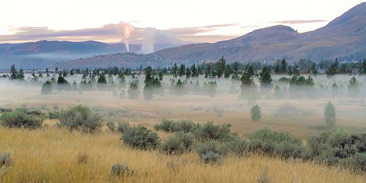
Rick Howie’s picture is used with permission.