Peter Bartl is a friend who lives on the high ground of Balfour. Knowing of my interest in things meteorological, he asked:

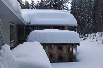
Although there are much lower snow depths elsewhere, the early-February snows of Peter Bartl's upper Balfour are deep.
Why do we … above Balfour, have so much more snow than everybody else along the West Arm … as you drive into Nelson, [there is] often no snow in spots along the way?
The short answer is that Balfour is exposed to southeasterly winds in a way that the rest of the West Arm is not.
Much of the heavy snow of winter arrives with the approach of cyclones—the travelling areas of low pressure that move over us from the west. That snow falls from the mid–levels of the atmosphere where it formed well above our mountain tops. If nothing else happens, that snow falls fairly uniformly across the region. But, something else does happen around Balfour—something that is different than elsewhere on the West Arm.
As a storm approaches, the low–level winds (below the mountain tops) are from the south to southeast, and as a map reveals, Balfour is open to those winds in a way that the rest of the Arm is not. As the air flows up the mountain slope above Balfour, low–level clouds form. Those clouds don’t actually produce much snow on their own, but they do greatly modify the snow from higher up as it falls through them. The snow from above grows quickly as it passes through those moisture–rich lower clouds. This produces considerably more snow for upper Balfour.
And there you have it: Balfour’s exposure to southeast winds produces low–level clouds that enhance the local snowfall well over that which falls elsewhere along the West Arm. The same explanation should apply to the Township of Queens Bay.
