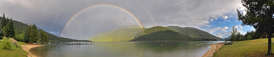
Peter Bartl is a friend who lives on the high ground of Balfour. Knowing of my interest in things meteorological, he asked:
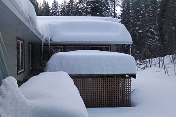
Although there are much lower snow depths elsewhere, the early-February snows of Peter Bartl's upper Balfour are deep.
Why do we … above Balfour, have so much more snow than everybody else along the West Arm … as you drive into Nelson, [there is] often no snow in spots along the way?
The short answer is that Balfour is exposed to southeasterly winds in a way that the rest of the West Arm is not.
Much of the heavy snow of winter arrives with the approach of cyclones—the travelling areas of low pressure that move over us from the west. That snow falls from the mid–levels of the atmosphere where it formed well above our mountain tops. If nothing else happens, that snow falls fairly uniformly across the region. But, something else does happen around Balfour—something that is different than elsewhere on the West Arm.
As a storm approaches, the low–level winds (below the mountain tops) are from the south to southeast, and as a map reveals, Balfour is open to those winds in a way that the rest of the Arm is not. As the air flows up the mountain slope above Balfour, low–level clouds form. Those clouds don’t actually produce much snow on their own, but they do greatly modify the snow from higher up as it falls through them. The snow from above grows quickly as it passes through those moisture–rich lower clouds. This produces considerably more snow for upper Balfour.
And there you have it: Balfour’s exposure to southeast winds produces low–level clouds that enhance the local snowfall well over that which falls elsewhere along the West Arm. The same explanation should apply to the Township of Queens Bay.


 Has the City of Nelson taken to imploring the Great Goddess of Weather to send no further snow for this winter? It might seem so: Arlene Anderson spotted this sign lying in the snow of Lakeside Park. Its message, to stay off the grass, is directed skyward.
 The line for the multi–year average is purple. It peeks in early May at about 1400 mm of snow (water equivalent). At the end of January, the depth is about 800 mm, so nearly ½ the snow has yet to fall. This year’s plot is in dark blue and reveals this to be an average year.


 Marnie Lehr’s picture is used with permission.
 Doug Thorburn’s pictures are used with permission.
McDonald’s Landing
The dock at McDonald's Landing
In 1894, Duncan A. McDonald filed a pre–emption for some land at Six Mile on the West Arm of Kootenay Lake. The landing named for him is located near the east end of Lower Six Mile Road. It is one of the few along the lakeshore which was built and maintained by the government (another one, now long gone, was Fraser’s Landing).
I have used McDonald’s Landing many times starting in the 1940s when I would travel from it to Camp Koolaree. The landing has remained under the control of Fisheries and Oceans until, apparently, this year at which time it will come under the local control of the RDCK.
The story contains two distinctly odd features. First, it includes an aerial view of Balfour but incongruously implies that it is the Landing (which is not visible in the picture and many kilometres away). Second, the story goes on to discuss someplace called Camp Coolery (since the original posting, this has been corrected).
All in all, not one of the editor’s better days.
Incidentally, I have been unable to learn the proper spelling of the landing. I have seen the mac with and without an a, and the s with and without an apostrophe. With any luck, the RDCK will standardize it, preferably without the a and with the apostrophe.